Spain - Marine/Nautical Charts 102.0
Paid Version
Publisher Description
GPS Marine Charts App offers access to charts covering Spain waters (derived from IHM ( Instituto Hidrográfico de la Marina)data).
Only marine GPS app to have route assistance with Voice Prompts for marine navigation. It has route manager to create new boating routes or import existing GPX/KML routes. It supports Nautical Charts course up orientation.
Please visit
http://gpsnauticalcharts.com/main/spain/all-all-spain-charts-nautical-charts-folio.html
for complete list. If you don't find the chart for Spain , please contact us at support at gpsnauticalcharts.com.
* Voice Prompts for marine navigation (requires GPS )
-prompts when approaching a boating route marker
-Continous distance and ETA updates
-Alerts when sailing/boating off route
-Alerts when boating in wrong direction
*Route Editing/Creation
-Create routes from scratch
-Edit existing GPX/KML routes.
-Add custom description to any route point.
-Drop markers along route.
► Advanced NMEA Instrumentation
√AIS over TCP/UDP
√Wind speed, direction, temperature, depth, GPS over NMEA
* Offline charts derived from IHM data.
-Visually draw area to download
-Textual search
-Catalog
-Charts reprojected for WGS84 datum
*Seamless chart quilting of marine charts
*Distance Bearing tool
*Create custom way points
- Using GPS
-Select point on map
-Manually enter latitude & longitude coordinates
*Pan/Zoom/My Location
* Record Marine GPS tracks
* View tracks overlay
* Live track animation
* Track analytics/stats
* Export GPX tracks.
-Export to SDCard
-Share GPX trakcs with friends/View on Google earth.
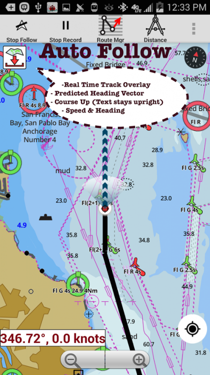
* Auto Follow Mode (Course up)
-Continuously updates boat's location on chart
- Adjustable update frequency
Sample Nautical Charts
Tanger-Mediterranee
Baie de Fontarabie or Rada de Higuer
Channels Between Ibiza and Formentera
Denia
ADRA
Ensenada de San Simon
Algeciras
Canary Islands
Alicante
Almeria
Luarca
Pobla de Farnals
Alicante
Barcelona
Bilbao
Cartagena
Gijon
Malaga
Palma
Ria de Arousa
Valencia
Ria de Corme y Laxe
Rio Guadalquivir
Santa Uxia de Ribeira
Bahia de Cadiz
Pobra do Caraminal
San Sebastian and Pasaia (Pasajes)
Barcelona
Barcelona to Napoli including Islas Baleares Corse and Sardegna
Bay of Biscay
Garrucha
Bilbao
Port Saplaya
Ria de Camarinas
BSan Esteban de Pravia
Cabo de San Antonio to Vilanova i la Geltru including Islas de Ibiza and Formentera
Cabo de San Lorenzo to Cabo Ortegal
Cabo de Santa Maria to Cabo Trafalgar
Cabo de Sao Vicente to the Strait of Gibraltar
Cabo Finisterre to the Strait of Gibraltar
Cabo San Sebastian to Iles d'Hyeres
Cabo Torinana to Punta Carreiro
Cadiz
Aguilas and El Hornillo
Cartagena
Cartagena to Cabo de San Antonio including Isla Formentera
Castellon
Castro Urdiales
Ceuta
Getaria
Melilla and Port Nador
Ria de Navia
Vilanova de Arousa and San Xulian de Arousa
Melilla and Port Nador
Cambados and San Martin de o Grove
Ondarroa
Sant Carles De La Rapita and Alcanar
Eastern to the Strait of Gibraltar
E Barra Del Rio Guadalquivir
Carboneras
Lekeitio
Ensenada de San Ciprian
Elantxobe and Lekeitio
Gandia
Elantxobe
Gibraltar Bay
Gijon
Ria de Santona
Santa Cruz de Tenerife
Ibiza- Formentera and Southern Mallorca
Isla de Alboran
Islas Sisargas to Montedor
La Coruna and
Mahon
Malaga
Mallorca and Menorca
Marin and Pontevedra
Menorca
Menorca to Sicilia including Malta
Mimizan-Plage to Cabo de Ajo
MOTRIL
Motril to Cartagena including Isla de Alboran
Palma
Pasaia (Pasajes) and
Alcudia
Carino
Ferrol
Huelva
Puerto de Lastres
Puerto de Luanco
Ribadesella
Bermeo and Mundaka
Punta de la Bana to Islas Medas
Punta de la Estaca de Bares to Cabo Finisterre
Punta Salinas to Punta Beca including Isla de Cabrera
Punta Umbria
Ras Tarf to Oran
Ria de Arousa
Ria de Aviles
Ria de Cedeira
Ria De Ferrol
Ria del Barquero
Ria de Muros
Gran Canaria to Hierro
Caballo
Puerto de la Luz (Las Palmas)
Salinetas
Puerto del Rosario
Saplaya
About Spain - Marine/Nautical Charts
Spain - Marine/Nautical Charts is a paid app for Android published in the Recreation list of apps, part of Home & Hobby.
The company that develops Spain - Marine/Nautical Charts is Gps Nautical Charts. The latest version released by its developer is 102.0. This app was rated by 2 users of our site and has an average rating of 2.5.
To install Spain - Marine/Nautical Charts on your Android device, just click the green Continue To App button above to start the installation process. The app is listed on our website since 2016-12-19 and was downloaded 77 times. We have already checked if the download link is safe, however for your own protection we recommend that you scan the downloaded app with your antivirus. Your antivirus may detect the Spain - Marine/Nautical Charts as malware as malware if the download link to com.skiracer.nautical_astore_es is broken.
How to install Spain - Marine/Nautical Charts on your Android device:
- Click on the Continue To App button on our website. This will redirect you to Google Play.
- Once the Spain - Marine/Nautical Charts is shown in the Google Play listing of your Android device, you can start its download and installation. Tap on the Install button located below the search bar and to the right of the app icon.
- A pop-up window with the permissions required by Spain - Marine/Nautical Charts will be shown. Click on Accept to continue the process.
- Spain - Marine/Nautical Charts will be downloaded onto your device, displaying a progress. Once the download completes, the installation will start and you'll get a notification after the installation is finished.
